


Blogs/Reports from Researchers
Some of the GEOEO24 scientists will be blogging/reporting their work while on board I/B Oden during the North Greenland expedition.
Wall of icebergs in front of the Ostenfeld Glacie
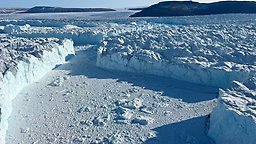
by co-chief Nina Kirchner, Co-Chief Scientist and Professor of glaciology at Stockholm University.
September 5
Lincoln Sea - heading towards Petermann Fjord
Now that we for a few days will focus exclusively on marine activities, there is time to write about our investigations of the glaciers C.H. Ostenfeld and Ryder and about our plans to visit the Petermann Glacier before we finish the expedition in Pituffik in about two weeks.
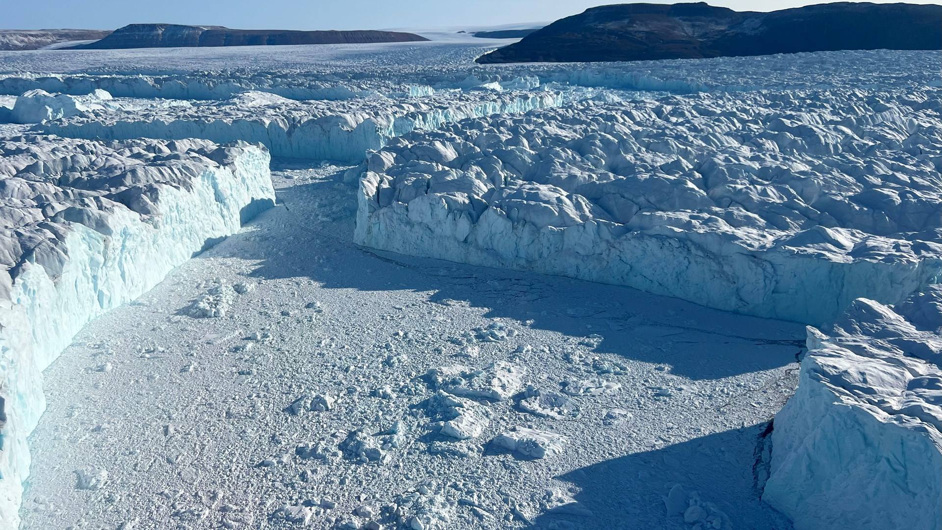
Large icebergs in front of the Ostenfeld glacier font. Photo: Nina Kirchner
The Ostenfeld, Ryder, and Petermann glaciers are adjacent to each other along the northern coast of Greenland and, for a long time, were some of the last to have floating ice tongues that stretched several miles along each fjord (Victoria Fjord, Sherard Osborn Fjord, and Petermann Fjord). From the Petermann Glacier, large icebergs have calved on several occasions in the last decade – the ice tongue became up to 30 kilometers shorter – while the Ryder Glacier Tongue has been more stable because it is more protected from warm water entering Sherard Osborn Fjord. We know this because of our investigations during previous expeditions with the icebreaker Oden (Petermann-2015 and Ryder-2019).
When we came to Victoriafjorden with Oden in mid-August, the Ostenfeld Glacier was an area we had not seen before with our own eyes, we had only seen satellite images. In the Victoria Fjord, there was so much pack ice, large ice floes, and icebergs that had calved from the Ostenfeld Glacier that Oden couldn't get close to the Ostenfeld glacier front. It only showed up during our first reconnaissance flight with the helicopter. We were completely overwhelmed by what we saw: the front lay behind a zone more than a mile wide of icebergs 30 meters high and several hundred meters wide and long, with narrow strips of sea water in between, which could usually only be discerned under a cloud of what looked like ice flakes but were pieces of ice the size of trucks. It can be difficult to understand sizes in this environment!
We investigated the Ostenfeld glacier, but with the help of a so-called ice radar, to find out, among other things, what the bedrock under the ice looks like, how it affects the ice flow, and how the glacier's thickness varies. We have also mapped the front area using a drone to get a detailed picture of the glacier's cracked surface. The first analysis of collected data shows that the glacier front is on the seabed and is a total of about 300 m high, but only about 30 meters is visible above the water surface. The glacier's surface looks like a sea of cracks, partially filled with water. Large lakes have formed on the glacier's surface, meaning that some melting has occurred at the surface, but the glacier is compactly frozen at greater depths.
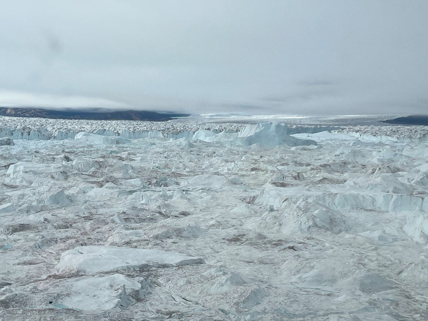
C. H. Ostenfeld glacier front. Photo: Nina Kirchner
After completely problem-free operations of the ice radar at the Ostenfeld Glacier, we continued with similar measurements at the Ryder Glacier, where the focus was to locate the otherwise inaccessible so-called grounding area, i.e. where the glacier begins to lift from its underlying bedrock to transition to just a floating glacier tongue, with fjord water and the seabed below. Initial analyses suggest that the grounding zone has moved further landward and that meltwater channels on the underside of the ice—previously unreported, but we can see indications of in our newly collected data—may have played a role in this retreat. The front of the Ryder glacier looks very tidy compared to the front of the Ostenfeld glacier😊.
Now we are going towards Petermann to supplement with ice radar surveys there too!
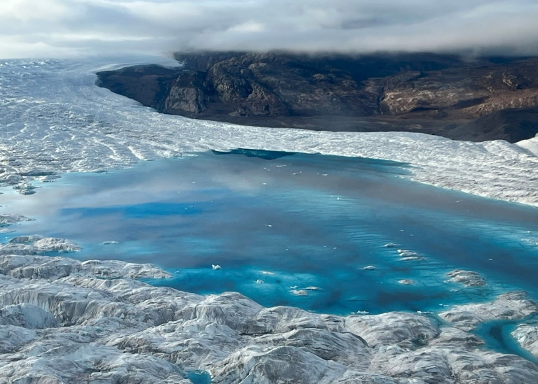
Meltwater lake at the C.H. Ostenfeld Glacier. Photo: Nina Kirchner
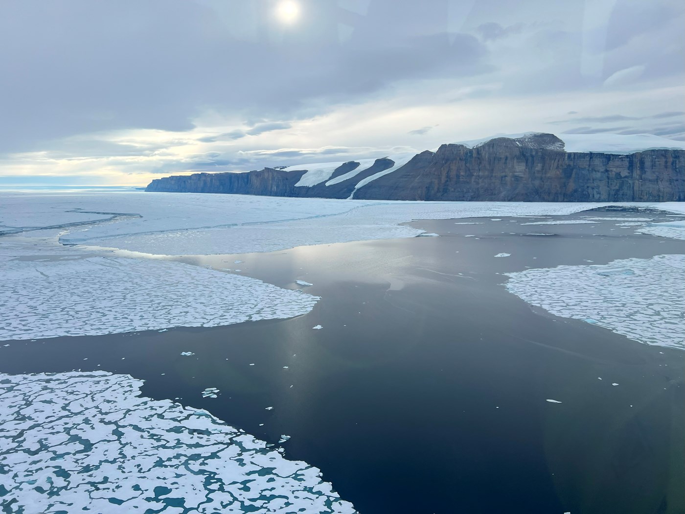
Ryder glacier calving front in Sherard Osborn Fjord. Photo: Nina Kirchner
Notes from The U.S. Team
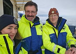
The U.S. team on GEOEO24, is from the Center for Coastal and Ocean Mapping (CCOM) at the University of New Hampshire (UNH) which is the U.S. center of excellence for research in ocean mapping.
There are three of us from the U.S. on GEOEO24 (Brian Calder, Larry Mayer and Liz Weidner) though one of us (Brian) is Scots. Our group is from the Center for Coastal and Ocean Mapping (CCOM) at the University of New Hampshire (UNH) which is the U.S. center of excellence for research in ocean mapping. Larry is Director of the Center, Brian, Associate Director and Liz recently finished her Ph.D. at UNH, spent the last year as a Postdoctoral Fellow at Scripps Institution of Oceanography, and will soon be starting a new faculty position at the University of Connecticut.
September 3
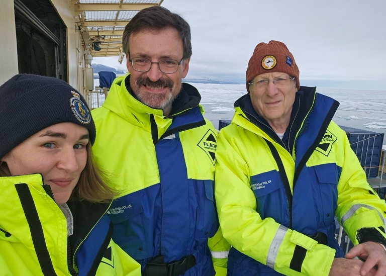
The U.S. Team on GEOEO24: Larry (right), Brian (center), and Liz (left). Getting ready to deploy USV Echoboat in Victoria Fjord. Photo: Liz Weidner
Our participation in GEOEO24 is the natural extension of a remarkable history of collaboration that began almost forty years ago between Professor Jan Backman from Stockholm University and Larry working together on many deep-sea drilling projects, mostly in the equatorial Pacific. This eventually led to collaboration in the Arctic on the ACEX Arctic drilling proposal, Martin Jakobsson spending several years as a visiting researcher at CCOM and then our participation in the SWERUS, Petermann, and Ryder Expeditions.
There are three of us from the U.S. on GEOEO24 (Brian Calder, Larry Mayer and Liz Weidner) though one of us (Brian) is Scots. Our group is from the Center for Coastal and Ocean Mapping (CCOM) at the University of New Hampshire (UNH) which is the U.S. center of excellence for research in ocean mapping. Larry is Director of the Center, Brian, Associate Director and Liz recently finished her Ph.D. at UNH, spent the last year as a Postdoctoral Fellow at Scripps Institution of Oceanography, and will soon be starting a new faculty position at the University of Connecticut.
On GEOEO24, the small U.S. team is on board to contribute to the overall geophysical mapping program. We are standing eight-hour watches monitoring the Oden’s acoustic systems including the multibeam echosounder, subbottom profiler, EK80-scientific echo sounders and the ADCP (Acoustic Doppler Current Profiler). These systems offer the “geospatial context” for all else that we do on the ship. The multibeam echosounder provides a three-dimensional picture of the depth and shape of the seafloor that lets us know how and where warm ocean currents can enter the fjords and interact with the glacier (and thus affect the overall melting of the icesheet) as well as provide a picture of how the glaciers advanced and retreated over time. It also is essential for determining whether the Oden can safely navigate in the uncharted waters in the area. The subbottom profiler provides the fourth dimension, letting us look back in time at the history of sediments deposited on the seafloor and identify locations for sediment cores that, when analyzed, provide the timing of glacial events. The scientific echo-sounders give us high-resolution pictures of biological activity and oceanographic boundaries in the water column. The Acoustic Doppler Current Profiler offers insight into the deep currents below the vessel. All of the other teams on board need these data to understand the spatial context of their biological, oceanographic or geochemical data.
The U.S. team also came with our own science goals – our hope to use a small uncrewed surface vessel (USV) to get very close to and map the “glacial front” to better understand its morphology and ablation (mass loss) processes. The USV we brought was a Seafloor Systems Echoboat, a 1.7 m long, remote-controlled vessel equipped with a Norbit iWBMS multibeam echosounder with integrated inertial navigation and motion sensors, several cameras, and a Conductivity-Temperature-Depth (CTD) sensor for measuring water properties. The multibeam echosounder can be exchanged with a 200 kHz EK80 scientific echosounder for detailed mapping of the water column.
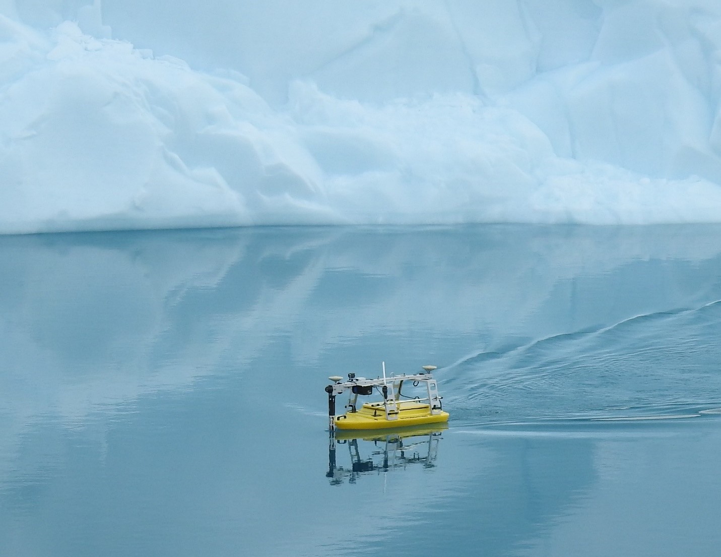
Echoboat surveying an iceberg. Photo: Larry Mayer
As the ODEN made its way into Victoria Fjord, it became clear that ice would prevent us from gaining access to the “glacial front”. Moreover, the helo reconnaissance showed that in Victoria Fjord there was no simple glacial front, but rather a very complex region of breakup of the glacier at the grounding line. Such surprises are not uncommon when exploring unmapped regions and lead to the need for flexibility and innovation. We first attempted to use Echoboat as a helo-deployed echo-sounder carrying a borrowed (from Christian Stranne) deep-water scientific echosounder, but this failed because the wireless receiver on the Echoboat got a bit more wet than it was meant to, taking out the communication system. Fortunately, Christian and the team from KTH pieced together another system and were successful in making important depth measurements by helo deep into the fjord. Indicative of the spirit of collaboration on board, the KTH team generously leant us one of their wireless links and we were able to resurrect the Echoboat (appropriately rechristened Lazurus) and turn our focus to understanding the melting processes of the large icebergs that sit in the fjord. Initially we used Oden’s workboat Munin to deploy the Echoboat to an iceberg in relatively open water, but later we were able to deploy the Echoboat directly from Oden, making launch and recovery much simpler.
We have been able to survey four different icebergs and have been very pleased with the initial results. We have already produced 3-D images of the underwater morphology and structure of the icebergs noting consistent differences in underwater texture that appear to be related to above-water processes. We also believe that we can see meltwater plumes in the sonar imagery and are now working on creating 3D models of the parts of the iceberg that are above water. These are just very initial results; we have much work to do with these and all the other data sets collected on board. One thing is certain, however, and that is that the “risk” taken to bring Oden to Victoria Fjord has more than paid off. Each of the teams on board will come home with unique data sets from a virtually unexplored region that will become important contributions to our broader understanding of changes in the Arctic and their global impacts.
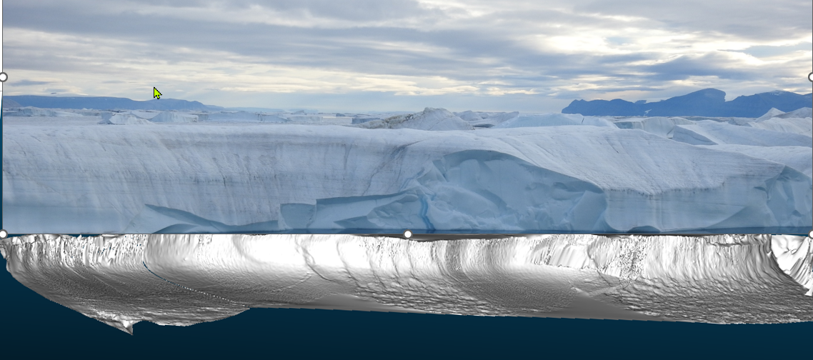
A 3-D rendering of underwater part of iceberg (bright white) with relatively flat shelf at about 12m depth. Photograph is approximate location of iceberg above waterline.
Successful data collection in the Victoria and Nordenskjöld fjord
Report for GEOEO North of Greenland 2024 Expedition by co-chief Martin Jakobsson, Professor at the Department of Geological Sciences, Stockholm University and Principal Investigator (PI) for Work Package 1: Geophysical mapping.
September 1
As of September 1st, we have returned to the entrance of Victoria Fjord with IB Oden after spending 16 days in the fjord and the nearby Nordenskjöld Fjord to the north. Today, we are departing from this area to re-enter the Lincoln Sea and begin our attempt to head northward, in line with our initial expedition plan. We are fully aware of the challenges and the significant risk of being forced to turn back and return to Pituffik if the sea-ice conditions prove too difficult. No ship has ever traversed the Lincoln Sea from south to north – or vice versa – for good reason. The first task on today’s agenda is an ice reconnaissance flight with the helicopter. I flew alongside Captain Erik Andersson and Åsa Lindgren from the Swedish Polar Research Secretariat. If we cannot make it all the way through the Lincoln Sea, we will anyway be able to collect data from a completely unsampled region while returning south to Nares Strait.
The data collection in the fjord has been far more successful than I had dared to hope, even if the amazing armada of icebergs from the collapsed ice tongue efficiently put a stop to us at about 37 km from the fjord mouth. We have acquired over 1,520 square kilometers of multibeam bathymetry, which is a few hundred square kilometers larger than the island of Öland, Sweden’s second largest island. Along with the bathymetry, we also collected sub-bottom profiles, midwater sonar data, and current information from the Acoustic Doppler Current Profiler (ADCP).
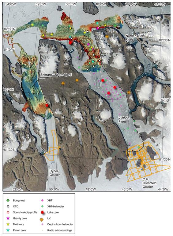
The multibeam bathymetry shown in Sherard Osborn Fjord were collected during the Ryder 2019 Expedition with Oden. Illustration: Martin Jakobsson
Our general operation mode involved mapping the seafloor at night, as the area is completely uncharted, and conducting data acquisition at stations during the day. Station work included retrieving sediment cores using piston, gravity, and multi-corers, collecting water samples, and measuring ocean properties with a CTD (Conductivity, Temperature, Depth). We deployed a “Bongo net” to capture living plankton for species study in these remote areas. We also carried out extensive work on land. The two helicopters were busy flying out our two geologists to study the geology and place a set of seismometers along the eastern side of Victoria Fjord, as well as the teams collecting driftwood, shrubs, and drilling in lakes. Four lakes were successfully drilled using a Nesje piston. A major component of our program led by Nina Kirchner, my co-chief colleague, was using radar echosounding from helicopter to measure the thickness of the C.H. Ostenfeld Glacier around its margin and the Ryder Glacier at its current grounding location. A total of about 700 km profile lines were flown.
The American group from the Center for Coastal and Ocean Mapping (CCOM) at the University of New Hampshire led by Larry Mayer, along with the team from KTH, used small remotely controlled vehicles to map icebergs. This began with taking Oden’s small workboat Munin close to an iceberg near Stephenson Island at the entrance of Victoria Fjord to support the remote-operated vehicles, Echoboat (CCOM/UNH) and Kuninganna (KTH). On a later occasion, Echoboat was used directly from Oden. It actually proved to be able to go over some thin ice that we thought was going to block its path. Additional activities with small boats we brought, Munin and Skibladner, include measuring methane along the shores and conducting seismic profiling and multibeam mapping.
In all, we have swept across the area and captured a huge amount of data that will help us understand this remote fjord, and in particular, the reason behind the complete collapse of C.H. Ostenfeld Glacier’s floating ice tongue in 2002.
Martin Jakobsson
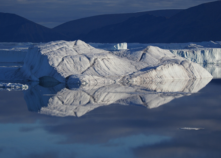
Icebergs in Victoria Fjord. Photo: Martin Jakobsson
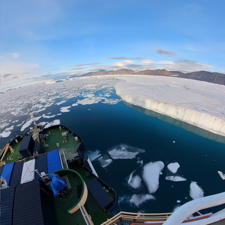
Icebreaker Oden in Victoria Fjord. Photo: Martin Jakobsson
Armada of icebergs in the Victoria Fjord during GEOEO
by Johan Nilsson, Professor at the Department of Meteorology, Stockholm University, Principal Investigator (PI) for Work Package 5: Interactions between the North Greenland Ice Sheet and Atlantic Water.
August 28 | 82°N, 48°W
We have now completed our exploration of the Victoria Fjord. Oden only managed to get 30 km into the 70 km long fjord. At that point the concentration of enormous icebergs became so dense that further progress was impossible.
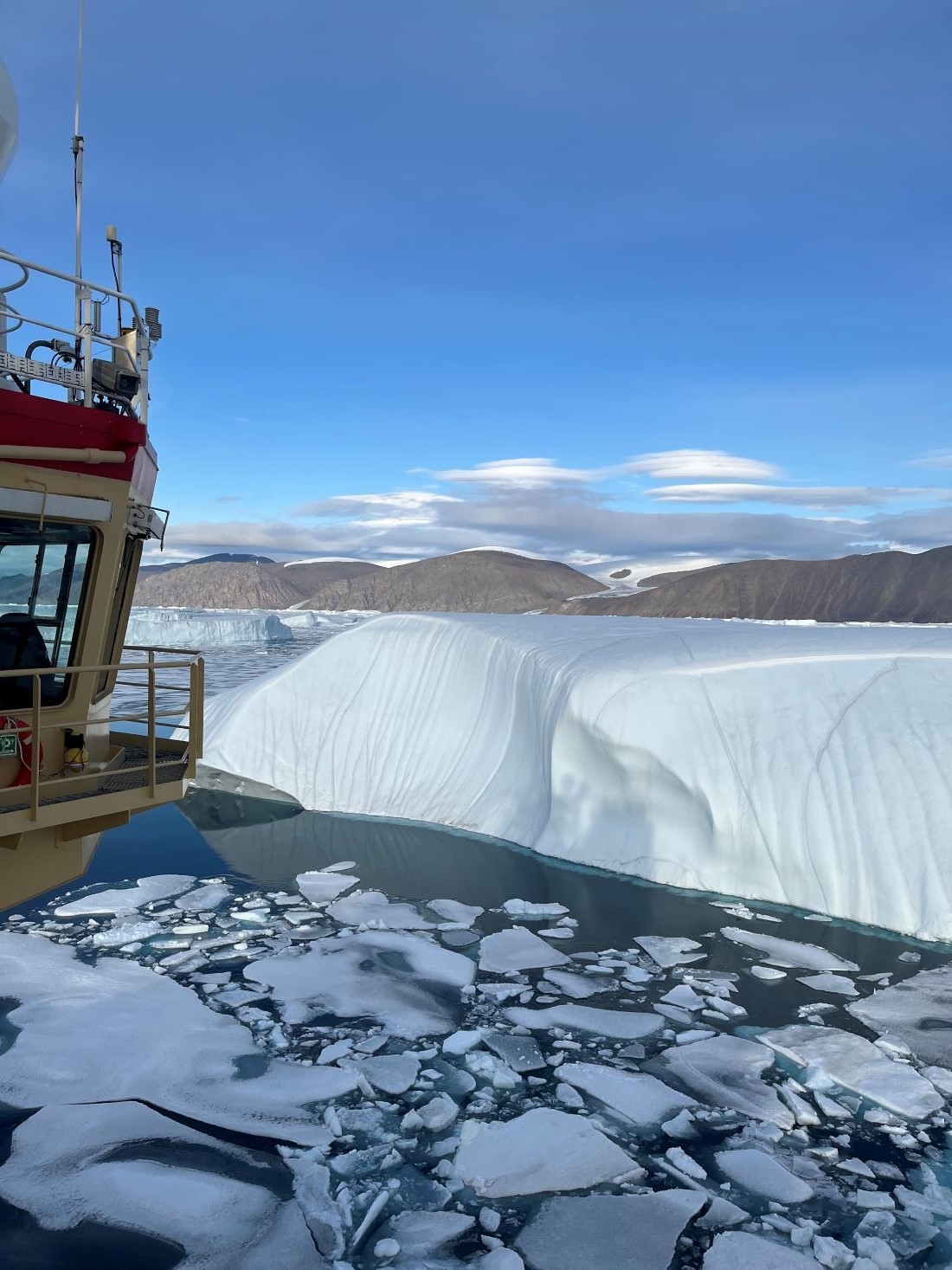
Photo: Johan Nilsson/MISU/Stockholm University
Some icebergs had horizontal extents of over 10 km, and several of them were as high as Oden (30 m), implying that they extend 300 m below the sea surface.
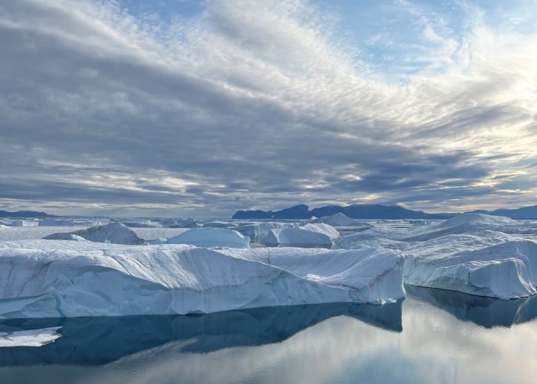
Photo: Johan Nilsson/MISU/Stockholm University
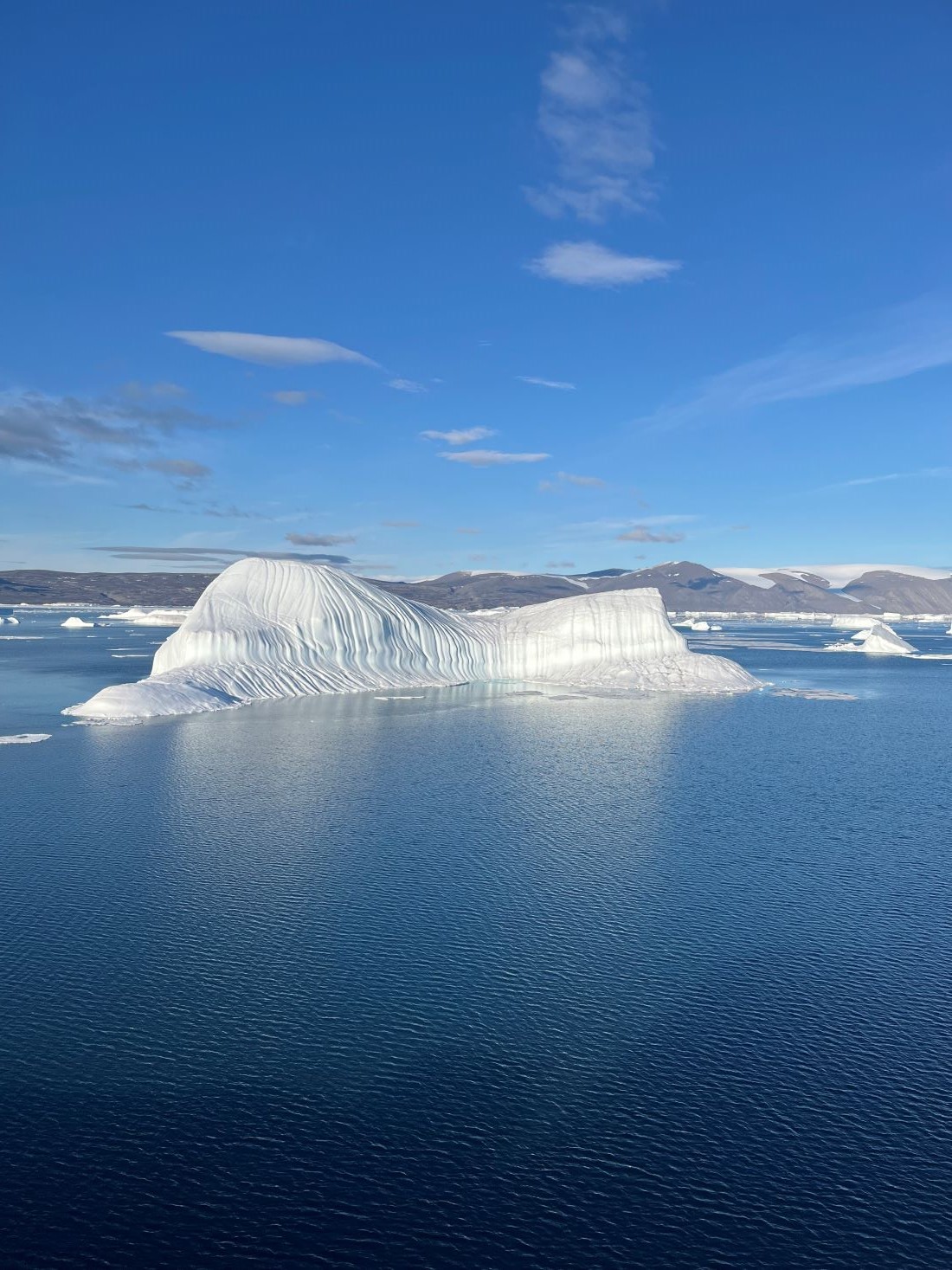
Photo: Johan Nilsson/MISU/Stockholm University
So far the expedition has been highly successful: we did not know if the thick multi-year sea ice in the Lincoln Sea would allow us to reach Victoria Fjord. Also, it has been a relatively cold summer in North Greenland, and sea ice in the fjord did melt away this year.
Given the harsh conditions here, we were lucky to reach the fjord at all, and to directly study its outer part.
Helicopter missions have allowed us to survey depth- and oceanographic conditions further into the fjord and the front of C. H. Ostenfeld Glacier, which is the source of iceberg armadas in the fjord.
August 20 | 82°N, 50°W
Arctic beauty at the Victoria Fjord during the GEOEO expedition
For the last few days, Oden has been operating just outside the Victoria Fjord. The setting is beautiful and dramatic.
At the fjord entrance Stephenson Island towers, nearly 1000m high with steep walls. The icy waters are laden with a myriad of large icebergs. These icebergs stem from the Ostenfeld Glacier’s ice tongue that disintegrated some 20 years ago, and spawned tabular icebergs that can be over 200 m thick and several kilometers long. The uncharted waters and the icebergs make Oden’s way into the fjord a slow and potentially hazardous enterprise.
The science and data collection is in full operation. We have begun to see indications that warmer water of Atlantic origin flow into the fjord, and melt the Ostenfeld glacier several hundreds of meters below the sea surface. One mission of the expedition is to examine if inflow of warmer Atlantic waters may have contributed to the break up of Ostenfeld’s floating ice tongue around 2002.
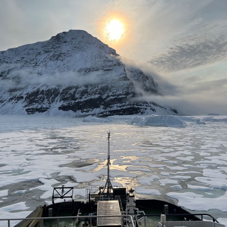
Photo: Johan Nilsson-MISU-Stockholm University
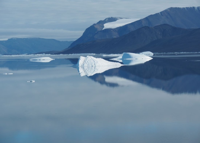
Photo: Johan Nilsson-MISU-Stockholm University
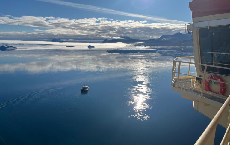
Photo: Johan Nilsson-MISU-Stockholm University
August 15
GEOEO expedition now at 82 degrees north
We have now reached deep into the Arctic and are at 82 degrees north, just off the coast of Greenland. Currently, we are at the entrance to the Sherard Osborne Fjord, which Oden visited in 2019.
The sea-ice conditions the past days have been very severe, and Oden has moved at a snail’s pace through heavily ridged, multi-year ice. Here, in the Lincoln Sea, the oldest, thickest and most deformed Arctic sea ice ends up. And this is the reason that Oden is the only ship that has ever visited these cold remote waters.
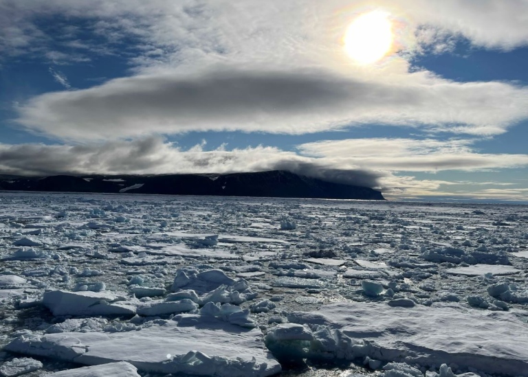
Photo: Johan Nilsson/MISU/Stockholm University
We are only about 20 km from our main objective: the Victoria Fjord. Due to the slow progress of Oden, there has been helicopter flights into the fjord, launching free falling temperature probes (XBTs) into the water. The results indicate that warmer Arctic Atlantic Water reaches into the deeper parts of the Victoria Fjord and melts the Ostenfeld Glacier that drains in the fjord.
Wild life sightings so far include narwhales, polar bears, seals, and polar foxes. And if there are no animals to watch, we can rest our gaze on the beautiful mountainous coast of Northern Greenland. As it is Thursday, we will have the traditional pea soup and pancake dinner.
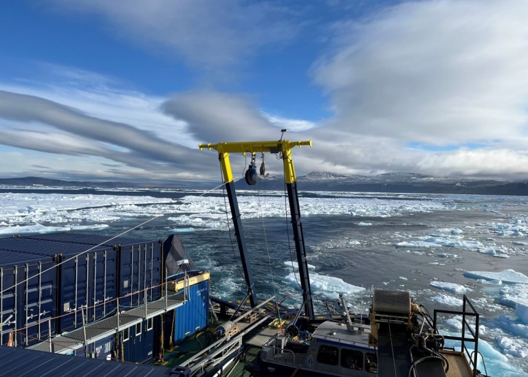
Photo: Johan Nilsson/MISU/Stockholm University
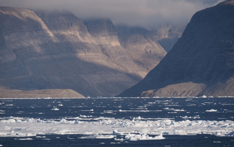
Photo: Johan Nilsson/MISU/Stockholm University
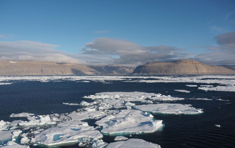
Photo: Johan Nilsson/MISU/Stockholm University
August 7
GEOEO expedition heading northwards in the Arctic
Oden has just begun its journey northwards from Pituffik (formerly Thule). Oden was anchored in the fjord outside Pituffik Air Base, which is the northernmost location with permanent residents in western Greenland.
We flew with the Swedish Air Force in a Hercules plane from Stockholm 05/08, with a planned fuel stop on Keflavik, Iceland. With over 70 passengers, Hercules was completely full with people and luggage: there was very limited room for limbs and bodily adjustments.
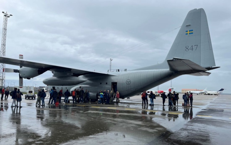
On Keflavik airport. Photo: Johan Nilsson/MISU/Stockholm University
When landing in Keflavik, we learned that due to low visibility in Pituffik we could not continue on the next leg of the flight. Instead, we got an afternoon and evening in Reykjavik; which was pleasant. The next day, flying conditions were fine en route to Pituffik, and we enjoyed marvellous views of outlet glaciers both on the eastern and western side of Greenland, as well as the mighty central ice cap.
The next few days, we will steam northward towards our targeted study area around Sherard Osborn and Victoria fjords in the northernmost part of Greenland. During the transit, we all will be busy preparing for the upcoming measurements. There are loads of equipment to get in order, and the two helicopters on board will be made ready for flight.
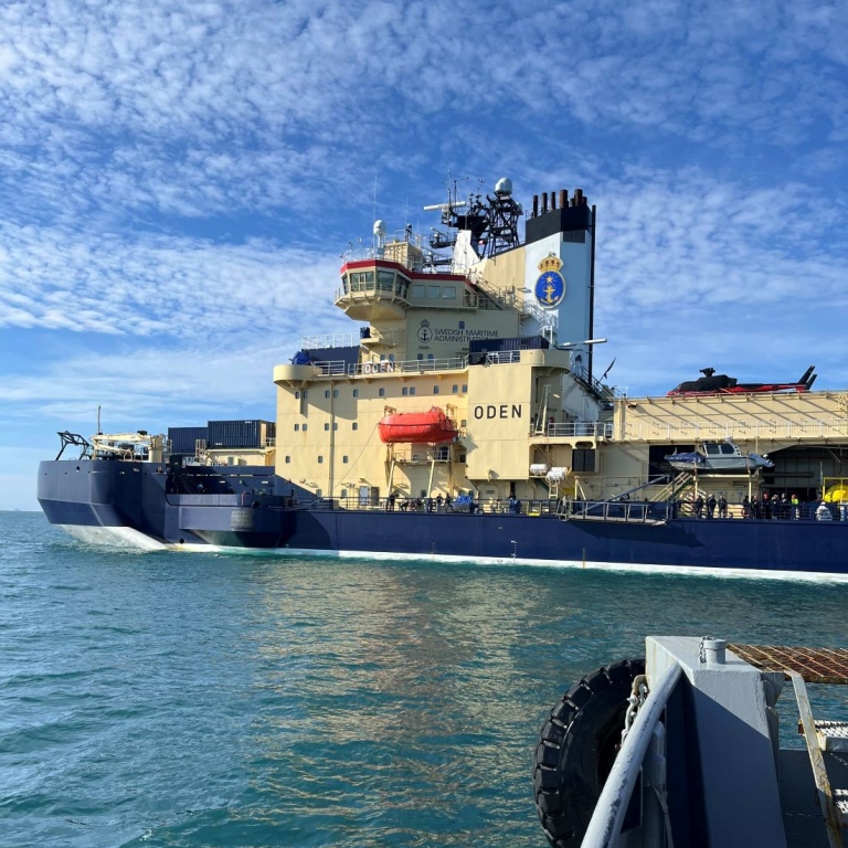
Oden in the fjord outside Pituffik Air Base (formerly Thule). Photo: Johan Nilsson/MISU/Stockholm University
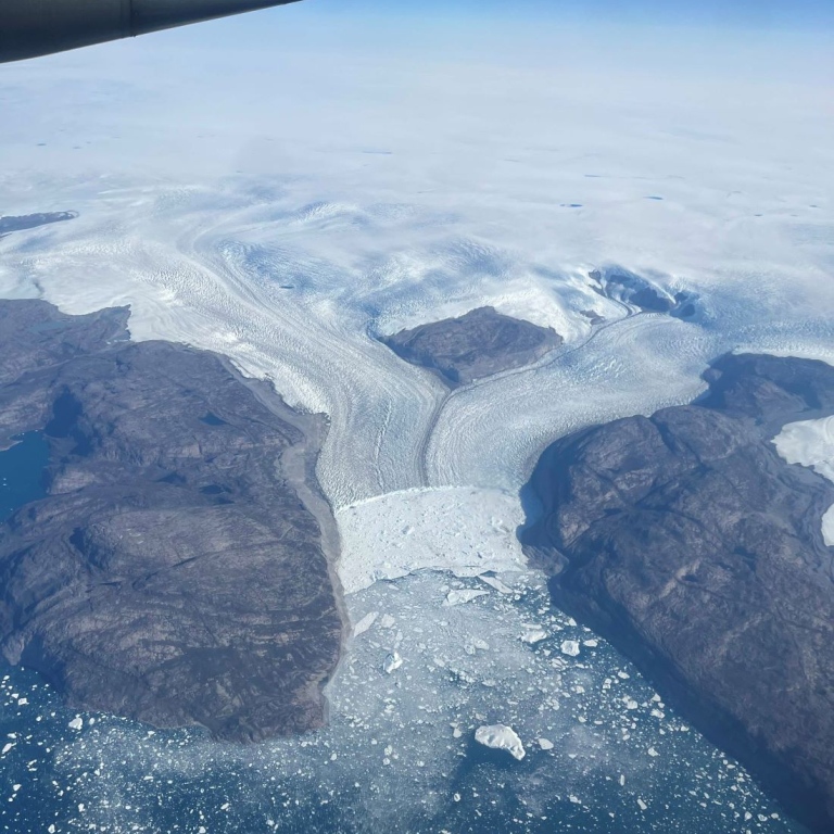
Outlet glacier in west Greenland. Photo: Johan Nilsson/MISU/Stockholm University
“Luck was on our side”
by co-chief Martin Jakobsson, Professor at the Department of Geological Sciences, Stockholm University, Principal Investigator (PI) for Work Package 1: Geophysical mapping
and
co-chief Nina Kirchner, Professor at the Department of Physical Geography, Stockholm University, Principal Investigator (PI) for Work Package 2: Glacier-Ocean multi-sensor and multi-platform Observatory.
August 20
Stephensons Island, Victoria Fjord
Icebreaker Oden reached the northern part of Nares Strait on August 10. This marks the point where the heavy sea ice of the Lincoln Sea begins and is typically the furthest that modern icebreaker expeditions can reach. The area of the Lincoln Sea and the adjacent central Arctic Ocean is often referred to as “the Last Ice Area,” as this is predicted to be the final region to maintain year-round pack ice if the current trend of diminishing sea ice continues.
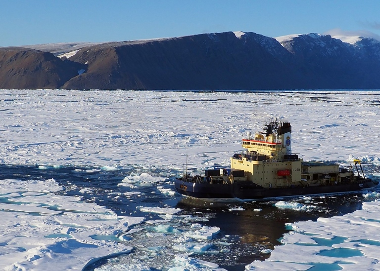
The icebreaker Oden near Stephensons Island. Photo: Martin Jakobsson
It was clear that continuing northward would be difficult, so the decision was made to stay in the area of Newman Bugt to conduct research and observe how the conditions evolve in the Lincoln Sea. After some very successful days of data collection, however, we decided on the evening of August 12 to attempt a push further north. It turned into a challenging battle against multiyear sea ice and pressure ridges. Our average speed was around 2 knots, and at times, we made no progress at all. Helicopter ice reconnaissance flights became essential during this period.
The toughest stretch was about 35 nautical miles north of Newman Bugt, but the ice became slightly more navigable as we approached Victoria Fjord. Finally, on August 15 in the evening, we reached the most northerly point of the Ryder 2019 expedition, when Oden was the first vessel to enter the Sherard Osborn Fjord where Ryder Glacier drains. From here, we had to begin mapping our way forward as the seafloor is unknown, and we cannot risk that Oden runs aground. The entrance of Victoria Fjord, where Stephenson’s Island is situated, was reached after about two days of mapping, and this is where we are now. We had estimated only a 20% chance of reaching the Victoria Fjord, so luck was on our side this time.
Text by Martin Jakobsson and Nina Kirchner, Stockholm University
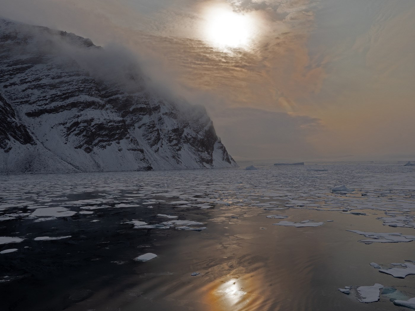
Northern Greenland. Photo: Martin Jakobsson
Greenland muskox
by Love Dalén, Professor at the Department of Zoology, Stockholm University, Principal Investigator (PI) for Work Package 6: Palaeogenomics of Ecosystem Change.
August 20
Victoria Fjord, 82.5 degrees North
It has been a long journey up to Victoria Fjord with icebreaker Oden, at times through several meters of thick ice. But now we are finally here! On the peninsulas around Victoria Fjord, there are several lakes that are an important component of our research project. We will use a floating platform to take sediment cores from the bottoms of the lakes, and then analyze prehistoric DNA from these cores. The aim is to investigate the history of the Greenland muskox, including how they were affected when the first humans arrived in Greenland.
So far, we have visited several lakes to examine their depth and determine their suitability for sediment sampling. We have found a lake that is perfectly suited for this, and we have flown out and assembled our sampling platform. Unfortunately, it was too windy to take a sediment sample. But we have left the equipment on the lake shore, and as soon as the weather is more favorable, we will fly out to the lake by helicopter and continue the work.
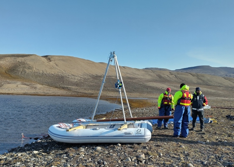
Rubber boat used to take sediment samples at one of the lakes near the Victoria Fjord. Photo: Love Dalén
Alongside the sediment sampling, we are also collecting prehistoric bones and teeth from muskox, which we will use to study their genomes at different points in time during the past 10,000 years. This collection has gone very well, and so far we have found about thirty bones and teeth. We will begin the DNA analyses on board the Oden in a special laboratory container that is adapted for ancient DNA analyses. However, we will not know the age of the remains until we return to Sweden and can perform radiocarbon dating.
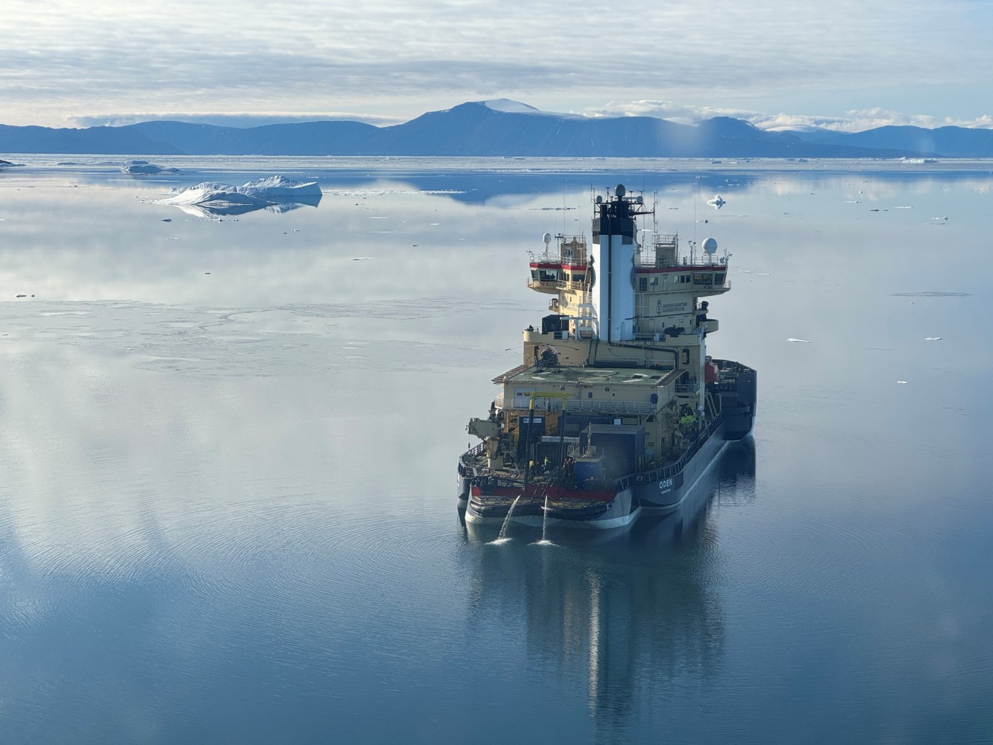
The icebreaker Oden in northern Greenland. Photo: Love Dalén
Last updated: 2026-01-15
Source: Department of Geological Sciences